This post was written in collaboration with Rachel Mead, who works at the Leventhal Map & Education Center as a GIS, Gallery, and Social Media Intern.
The Leventhal Map and Education Center is currently hosting an exhibition titled, America Transformed: Mapping the 19th Century. From 1800-1900, the US expanded westward, taking over land through war, treaty, trickery, and forced removal of Native groups. By the end of the 1800s, the country extended from the Atlantic to the Pacific.
The Spanish-American War represents a change by the US government and is reflected in maps from the era. The focus shifted from expanding westward to empire-building beyond the continent. As a result of this short military engagement—ten weeks between April and August, 1898—Spain lost its status as an imperial power and the United States became one.
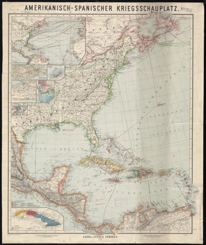
In the German map pictured below, one can see the extent of the war. This map includes territories in eastern Canada, eastern United States, Central America, and the Caribbean. In the top left corner is an inset that shows the reach of the war across the Atlantic.
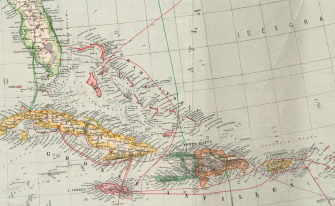
In this detail below, view the islands in the Caribbean. The color coding indicates the country each was governed by. Green was the US, yellow was Spain, and red was the British empire.
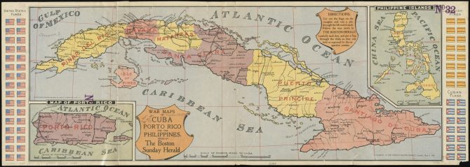
American involvement began after the explosion of the USS Maine in Havana in February. The war map pictured below was published by the Boston Herald in May 1898. This map was intended to help readers follow the action from home. They could cut out the flags in the margins and use them to mark the progress of each force. They didn’t have long to do so. The Spanish surrendered Santiago to the United States 121 years ago today, July 17, 1898. The following week, the US invaded Puerto Rico.
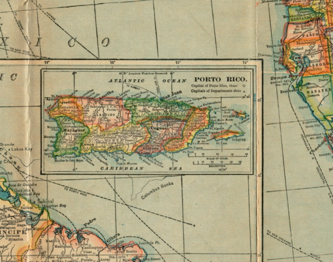
Maps of the United States from this time tend to include a lot more insets than previous iterations because of the rise in American imperialism. Since the US had control over locations not directly connected to the contiguous 48 states, the insets were needed to show the additional territories. The map below is from four years after the Spanish American War and was published in 1902.
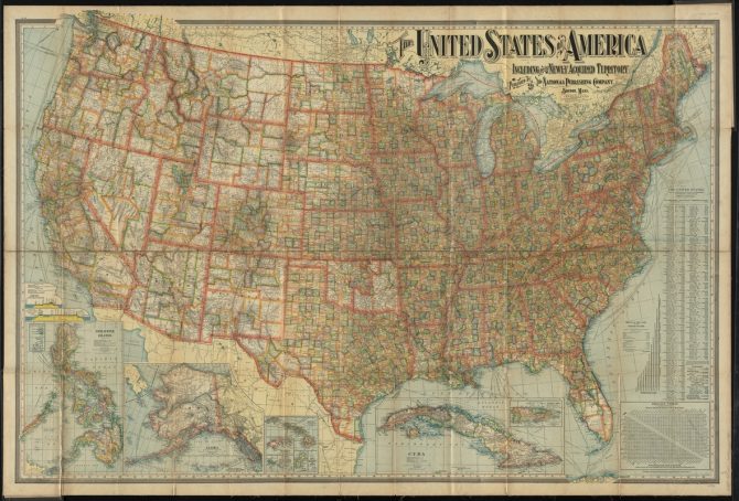
The Philippines, Alaska, Hawaii, Guam, Samoa, Cuba, and Puerto Rico are all on this map of “The United States of America: including all its newly acquired territory.” Much of this territory still belongs to the United States in some shape. Alaska and Hawaii are states, and American Samoa and Guam are unincorporated territories.
Four years after the war, close in time to the publication of this map, Cuba gained its independence, with the US retaining the right to intervene in its affairs. The Philippines did not have so quick a transition into independence. The US did not recognize an independent Philippines until 1946, after World War II.
Puerto Rico – called Porto Rico from 1898 to 1931 – is still not an independent country or a US state; it remains a US territory. Puerto Ricans are US citizens and pay Social Security and Medicare taxes. However, they do not have the right to vote in federal elections, and they are not represented in Congress. This has caused continued debates in Puerto Rico, the US Congress, and the United Nations. At issue: whether Puerto Rico should remain a US territory, become a US state, or become an independent country.
This map is currently on display at the Leventhal Map and Education Center in the Central Branch of the Boston Public Library. As a large floor map, visitors can explore the states and territories that made up the United States in 1902 and continue the conversation about the ongoing transformation of America.

Add a comment to: Maps and the Spanish-American War